|
|
Province
of Manitoba
1871,
by Lindsay Russell
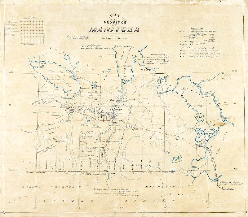
This 1871 map, produced by the Surveyor General Lindsay
Russell, was the first to show the province of Manitoba
as established under the Manitoba Act (1870). The map
also shows the beginning of the township surveys that
would divide the Prairies into homesteads for the millions
of families that would immigrate to western Canada from
Europe.
[more]
The small inset in the upper left corner shows Russell's
proposed plan for the western township surveys. The
township is divided into 64 sections, each of which
measured 800 square miles and contained quarter-section
homesteads of 200 acres. At the time, authorities
in the American West were offering prospective farmers
quarter-section homesteads of 160 acres. Some factions
in the government argued that if Canada's homesteads
were slightly larger, it might entice European immigrants
to select the North-West Territories over the United
States. In the end, the Canadian government decided
to follow the American model. Each township would
measure 36 sections and each square-mile section would
have quarter-section homesteads of 160 acres.
|