Common menu bar links
Institutional links
ARCHIVED - Treaty 8
Archived Content
This archived Web page remains online for reference, research or recordkeeping purposes. This page will not be altered or updated. Web pages that are archived on the Internet are not subject to the Government of Canada Web Standards. As per the Communications Policy of the Government of Canada, you can request alternate formats of this page on the Contact Us page.
Failed Expectations
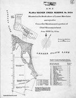
Sucker Creek Reserve Map
Sucker Creek was one of the first Treaty 8 reserves to be established. It was surveyed in 1901 and was located on Lesser Slave Lake, near the site of the original treaty signing.
Reserve lands were awarded at the rate of one square mile or 640 acres (259.2 hectares) per family of five "or in that proportion for larger or smaller families."

